Edineț (Edineţ)
Edineț (, Є́динці, יעדינעץ, Jedeńcy) is a town and municipality in northern Moldova. It is the administrative center of the eponymous district. The town is located 201 km north of the national capital, Chișinău. It is located at 48.16667°N, 27.31667°W. The town administers two suburban villages, Alexăndreni and Gordineștii Noi. The population at the 2004 census was 17,292 inhabitants, including 15,624 in the town itself.
To the North of the town is situated the commune Hlinaia (Glina-Mare), to the South – the town of Cupcini, to the East – the commune Ruseni, and to the West the suburb Alexăndreni.
The first known written mention of the locality is in a document from July 15, 1431, by which the Prince of Moldavia Alexandru cel Bun offered to a certain Ivan Cupcici "14 villages with their old domains and empty land to found new villages and an apiary". According to the document, the old name of Edineț was Viadineți, possibly meaning little Viadins. A document dating August 18, 1690, given by Prince Constantin Movilă to a certain Cozma Pop mentions the village as Iadineți. The name Edineț is documented since 1663, and still used to present days.
In 1812, eastern part of Moldavia was annexed by the Russian Empire, and became known as Governorate of Bessarabia.
Bessarabia proclaimed independence in January 1918 as Moldavian Democratic Republic. In April 1918, Bessarabia proclaimed union with Romania.
At the 1930 census, there were three separately administered localities: Edineți-Târg (literally Edineți-Fair), population 5,910, Edineți-Sat (literally Edineți-Village), population 5,260, part of Plasa Briceni of the Hotin County, and Alexăndrenii-Noi, population 1,083, part of Plasa Rășcani of the Bălți County.
In 1918–1940, along Edineț, two other spellings were sometimes used: Edineți and Edinița. Between the two World Wars there was a Zionist Tarbut school.
In 1940, the Soviet Union with the consent of the Nazi Germany occupied Bessarabia, and created the Moldavian SSR, closing privately owned businesses and religious schools. A year later, Romanian Army, now allied with the Nazi Germany, drove the Soviets out and recovered Bessarabia. The German and Romanian troops entered Edineț on July 5, 1941. Only a part of the Jews of Edineț fled before that. Within two days several hundred Bessarabian Jews of Edineț were murdered by units of Einsatzkommando D and Romanian gendarmes, assisted by quite a few civilians that came to profit from the Jews. Within the first two weeks, the Romanian soldiers had killed about 1,000 Jews out of 5,000 living in the town. Many women and young girls were raped; some of them committed suicide. The victims were buried in three large ditches, then the Jewish gravediggers who had interred the bodies were in turn murdered and buried on the same spot. In the middle of August a ghetto was set up. Surviving Jews of Edineț and others from different places from the north of Bessarabia, and from Bukovina were interned. In September there were about 12,000 Jews in the ghetto, crammed into a small area, suffering from malnutrition and disease. Many of the interned succumbed to disease, cold weather, hunger, and thirst; dozens of persons died every day. On September 16, 1941, all Jews were deported to Transnistria. The majority of them died in Transnistria. By 1944 only a few managed to survive. The few dozen families still alive at the end of the War settled either in Czernovitz or moved to Israel. Only a handful chose to return to Edineț.
In 1944, Soviets re-conquered Bessarabia, and re-established Moldavian SSR. During the Soviet time, the town was also known in the Russified versions Yedintsy and Yedintzi.
In 1960s, the Jewish population was estimated at about 200. There was no synagogue although the Jewish Cemetery was still extant.
Map - Edineț (Edineţ)
Map


Country - Moldova
 |
 |
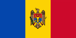
| Flag of Moldova | |
Most of Moldovan territory was a part of the Principality of Moldavia from the 14th century until 1812, when it was ceded to the Russian Empire by the Ottoman Empire (to which Moldavia was a vassal state) and became known as Bessarabia. In 1856, southern Bessarabia was returned to Moldavia, which three years later united with Wallachia to form Romania, but Russian rule was restored over the whole of the region in 1878. During the 1917 Russian Revolution, Bessarabia briefly became an autonomous state within the Russian Republic. In February 1918, it declared independence and then integrated into Romania later that year following a vote of its assembly. The decision was disputed by Soviet Russia, which in 1924 established, within the Ukrainian SSR, a so-called Moldavian autonomous republic on partially Moldovan-inhabited territories to the east of Bessarabia.
Currency / Language
| ISO | Currency | Symbol | Significant figures |
|---|---|---|---|
| MDL | Moldovan leu | L | 2 |
| ISO | Language |
|---|---|
| RO | Romanian language |
| RU | Russian language |
| TR | Turkish language |